

April 24-26, 2025, Arizona
A few months ago, we talked about the club trips for 2026. I offered an option of re-running El Camino Del Diablo, a famous 140-150 mile route in Sonoran Desert, close to the border with Mexico. The idea was accepted and trip put on the calendar.
The trip was scheduled a little too late – mid-April, with hot weather likely. About a month earlier the itinerary was updated – with a side trip to the aircraft crash sites added. A heads-up went out for the prospective participants to register with Barry Goldwater Bombing Range (a necessary condition for travel since the route crosses the military lands). A few people registered for the trip – and a few more were eager to go from outside the club.
But you only know who’s coming on the day of the trip. As it turned out, Bob Palmer and I were in attendance from LRCSD, Aaron and Gabrielle Shrier joined us from LA, and Dave S. with a friend – from Scottsdale. All of us owned and drove multiple Land Rovers in the past (I still do), but the line-up at Ajo Plaza showed three INEOS Grenadiers and one ROW Toyota Prado.
San Diego to Ajo
The day begins with a thoroughly enjoyable drive on Interstate 8 – there’s no traffic even on a Friday morning. Our rally point is in Ajo, Arizona – but first I meet with the Shriers at Jacumba Hot Springs.
The old U.S.80 near Jacumba is completely deserted. A couple of wild turkeys strut across the road unfazed by me driving by. The road crosses over the railroad tracks of the old San Diego – Arizona Railroad, now nearly abandoned and overgrown.


The border wall looms a few hundred feet south of the highway – I don’t know yet that this is the closest I’d ever get to the wall.
In Jacumba, kids are playing near an old Cadillac limo parked at a defunct gas station.


We have a great breakfast at the restaurant at Jacumba Hot Springs, pack things up, and depart towards Arizona.
Soon we “dive” under the sea level.
Some half an hour later, a familiar outline of sand dunes appear.


We fuel up at a gas station 10 miles east of Yuma, a couple of miles from where our trip will conclude two days later. Gas is indeed cheaper by a full dollar per gallon, but not quite the relief we hoped for. We still need to cover about 150 miles to Ajo Plaza.
We hear Bob on the radio even as we drive through Yuma, but we meet Dave and Jeremiah first at a gas station. A short supply run to Olsen’s Marketplace, and we ready to meet at Ajo Plaza.

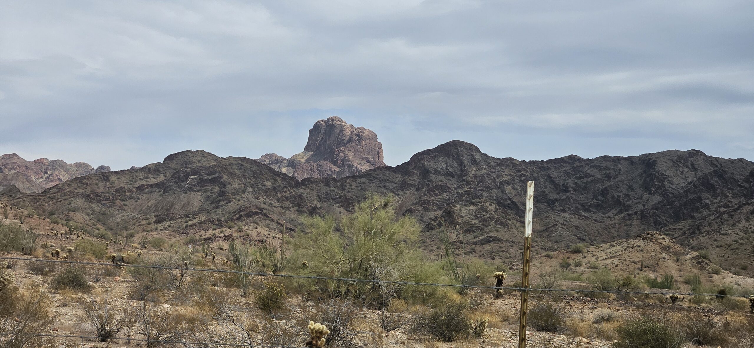
Ajo, a small community in the former lands of Tohono O’Odham, started its growth mid-19 century when the copper ore was discovered. Mining looked promising and drew interest on both sides of the border; in 1854, Mexico sent cavalry to Ajo to arrest American miners – the cavalry returned empty-handed, and area re-surveyed to prove that the town was about 40 miles north of the border.
It took another 40 years for the large copper mining operation to blossom, and multiple failed attempts to develop better technology to extract copper from ore. In 1910s, Ajo mining fell under the same management as Bisbee copper mine, and the open-pit ore extraction began.
The next few years passed in a flurry of activity.
In 1913, four deep water wells were drilled and Ajo’s water supply was established.
Sometimes in these years, ore leaching process perfected in Bisbee was established in Ajo, expanding the mining operation.
In 1915, a standard-gauge railroad connected Ajo with Gila Bend and Tucson.
In 1917, the passenger train station became the location of Ajo Plaza.
Ten years later, the Immaculate Conception Church was built across the main road from Ajo Plaza – designed by G.W.Smith, an architector famous for his work in Santa Barbara.
For over half a century, between 1930 and 1985, Ajo was practically a Phelps-Dodge company town (like Morenci, Douglas, Bisbee, Globe, Bagdad, and others). Mining ceased due to a combination of labor unrest and crash in copper prices, and the giant mine pit lays dormant, surrounded with rows of barbed wire. Phelps Dodge made another effort to resume mining in Ajo, and upgraded the railroad in 1998. Now, the tracks are slowly rusting away and reclaimed by Sonoran desert flora.


We spend some time mulling around Ajo Plaza, and then take off.


Ajo to Poso Nuevo
Our plans for the day are unclear – the original plan called for camping at the foot of John the Baptist Mountains, about 10 miles away. It is only 2 pm, and it will be much too early to stop there. We meander on the roads surrounding the mine complex, descend into the valley, and visit the campsite.
Since our last club trip to El Camino Del Diablo, the little memorial at the campsite grew by another plaque.


We have our late lunch at John the Baptist Mountains campsite, and return on the road. Sonoran Desert is lush and green, and not terribly hot – with a dust devil here and there. Soon, we cross from BLM lands into Organ Pipe Cactus National Monument.


Bates Well is a great place to make a stop and walk around, even if only a couple of buildings are left standing. This was the site of the cattle ranch working until 1976 – when Henry Grey, the last owner of the ranch, passed away, and the ranch, “grandfathered” inside the Organ Pipe Cactus National Monument for nearly forty years after its establishment, became part of it.


We spend some time around Bates Well compound, and return to Bates Well Road deeper into the desert.
Camping in Organ Pipe Cactus National Monument, and adjacent to it Cabesa Prieta Wilderness, is limited to 50 feet from the road. The options vary from none – in dense brush or cholla-infested areas, to fairly decent – wide, flat, and with great views. My worries about finding a spot for multiple vehicles along the road did not materialize – the entire route, with some notable exceptions, has campsites almost every few miles.
We drive to the junction with Poso Nuevo Road – five years earlier, we camped near the old Poso Nuevo Well under the watchful eyes of the U.S. Border Patrol. According to a story in the Desert Mountaineer, the well was hand-dug by the members of the Grey family of cattle ranchers (which counted then-young Henry Grey), around 1910, which made it the oldest well in the Monument.
Now the stretch of the road we happily camped years earlier is closed to traffic, which makes us turn south towards the border. We find a campsite we like about 10 miles later and set up camp. It is still early, not even 5 in the afternoon. The air is clear and warm. The view from our campsite extends past the border wall – and we’ll hear the truck traffic on Mexican Hwy. 2 in the morning.
Tally for the day: 330 miles on pavement, 40 miles on dirt.* * *
Poso Nuevo to Tinajas Altas
It is noticeably cooler in the morning, and the skies are different – with the rising sun and blue sky peeping through wispy clouds. The wind picked up a bit. We get up early, have our breakfast, and are ready to go at 8 in the morning – that must be the record of the last few years!


Our plan for the day calls for crossing most of El Camino Del Diablo – out of Organ Pipe and into Cabesa Prieta, through the Playas and lava field, and north to the northwest corner of Cabesa Prieta to see the F-4 Phantom and F-14 Tomcat crash sites. We don’t know where we’ll be camping yet; we have about 90 miles to cover.
The road we camped on goes south to the border – but then it tracks east towards Lukeville. We retrace our steps to Bates Well Road (which becomes officially El Camino Del Diablo west of Poso Nuevo road), and soon leave the Monument.
In a few miles, we’re cresting the shallow Cholla Pass – and yes, jumping cholla is present and abundant. There are multiple campsites along the road, and I am busy poking the Grenadier’s touchscreen to record the waypoints for the future. Notably, every single two-track leaving ECD is marked “No Access,” “Official Use Only,” or “No motor vehicles.” Park Service must have been very busy.
The saguaros are beginning to blossom – and we stop a few times to take pictures of the beautiful white flowers. Near Papago Well, all little roads leading to Papago Mine are shut down as well. Somebody took their time to take the fun out of the traverse…
Every now and then the road snakes between old ironwood trees – which host myriad of birds. I try to take pictures of a flock of gorgeous little things with yellow bellies – brown-crested flycatchers or Bell’s Vireos – but they disappear as quickly as they showed up. Every couple of miles we see a flock of vultures circling above, and a gorgeous red-tailed hawk takes off right in front of my truck.


Monstrous dry ruts along the road announce our passage of the Playas – I hate to think what the place looks like after a decent monsoon storm. Multiple tracks veer off the main route – people must have been desperate to avoid the ruts – and carry on mostly parallel to the road.
All of a sudden, I see an oncoming vehicle – a big rig!!! Closer up, we see that this truck, with a long empty flatbed trailer attached, is mired in sand. For many miles afterwards, we wonder how the hell it could have possibly made as far as it did. Especially over the Pinacate lava field – it is rough as all lava field crossings are, rough even when it is flat.
As we motor on, we are treated to some action – from a quail family ambling along the road undisturbed by vehicle sounds, to a pair of V-22 Ospreys practicing low-level aerial refuel from a KC-130 tanker, then on to a dust cloud possibly resulting from a high-speed chase along the border with an Apache helicopter hovering very low and close. We ponder if we’re running into what the news call “a developing situation…”


We take a note of ALL two-tracks leading towards the border explicitly marked “Closed.”
Somewhere in the Tule Mountains, El Camino becomes a 30-foot-wide, well-graded, highway, with telltale signs of a heavy truck traffic. This started some 8 years ago with the beginning of the construction of the “Big and Beautiful Wall,” to the dismay of all desert rats. We stop at Tule Well, and are immediately greeted by a driver of an 18-wheeler water tanker truck. Hearing his comments about the traffic on this section of the route – which continues all the way to Wellton – we are happy that we are not here on a weekday. We pay a visit to the cairn built by the Boy Scouts in 1930s and designated a landmark in 1941; the dust raised by two tanker trucks made us skip the visit to the cabin and get back in the saddle.


To reach the aircraft crash sites, we need to break off the El Camino, and head north – but… the road is also very clearly marked “Closed.” This is becoming annoying. We continue on ECD until we leave Cabesa Prieta, and find ourselves a track headed north along the wilderness boundary.
The track, so prominent early on, soon becomes a “Chris Snell” road – that is, you only stop when it becomes clear that not a vehicle has gone this way for decades. We are pretty crafty at finding reasonably legal options, despite crossing deep washouts and fields of cholla, until we intercept a wide graded road going back towards Cabesa Prieta – exactly what we need.
Sure enough, we see a sign announcing the wilderness boundary, and a “Stop Drag” sign for Border Patrol, complete with “No military vehicles beyond this point.” Our excitement lasts exactly ten seconds until we see another “Official vehicles only” sign. Not willing to risk a hefty fine and negative publicity, we turn around, and return to the expansive flats of ECD Higway to the Wall.


Not much left to do… The crash sites now appear about an 80-mile detour away, so we turn towards Tinajas Altas instead. We arrive to a small campsite we’ve first visited five years prior, at the foot of the trail leading sharply uphill towards the “High Tanks,” or Tinajas Altas – eroded holes in the rock that occasionally contain rainwater (up to 20 thousand gallons, according to Wikipedia). It was an important water source for indigenous people along the Devil’s Road, and finding the tanks dry was really bad news for the travelers.
The rock formations are spectacular. I hope to come here again just to spend some time climbing the scalloped edges and see the water in the tanks.


We mull around the area for a while, and return to ECD. We’d like to return to the low desert south-west of us – via Tinajas Altas Pass.
When we checked in to the Barry M. Goldwater Range online visitor tracking website, we were advised that the pass was closed due to road work. We decide to check it out regardless – and find the road perfectly open and maintained beyond desert decency standards.
We plan to camp behind a hill at the bottom of the pass – but not before we check if we can see The Wall up close.
Guess what… No we can’t. We try the same approach as before, meaning starting on two-tracks not marked “closed” and trying to follow them as far as we can. Dave comments on the radio that it is not generally a good idea to follow faint two-tracks in the lands littered with potentially unexploded ordnance. None of the tracks we try reach the border, and only one that clearly does is not at all welcoming. Facing an irate Border Patrolman is not very high on our to-do list, so we give up.
It takes me some time to find a track that leads to the campsite – we’ve only been there two years ago, and it is already barely visible behind a high berm left by the Border Patrol road graders. The campsite is not even quarter a mile away, wide enough to accomodate a battalion, and with plenty of spaces suitable for a tent.


It’s not even four in the afternoon… But we sit down and enjoy the contents of my brand new 64-ounce flask full of Woodford Reserve. Soon, the campfire is roaring, and somehow lamb chops aren’t charred beyond recognition. We make a great progress with both lamb and whiskey, and chat until late at night.
Tally for the day: 95 miles, all on dirt.* * *
Tinajas Altas to Fortuna Mine
The night was cool and very windy. I could feel the truck swaying with an occasional strong wind gust; can only imagine what it felt in the tents. Yet again, we get up remarkably early – around 6 am, and exhaust our morning activities by eight. On a morning trip with a shovel, I discover pieces of aircraft flares all over the place – have to resist digging them out. The wind has picked up yet again, and packing up a tent becomes a multi-person job. Bob’s the only one tent-camping alone, so we pitch in before the shell flies away.
The road now crosses the bombing range proper – with very frequent laser and unexploded ordnancce warning signs, and very emphatic signs restricting the path along the road. We pass by the sight of Yodaville (“Birthplace of MK 76, Population 0”) – and for the first time I notice the plaque annotating this bizarre desert feature.


We pass the next 20 miles in an easy silence – occasionally stopping to take pictures. We see a rocky trail that GaiaGPS and OnX promise to take us to Fortuna Mine, and we jump on it (I have to make a promise of not taking a “Chris Snell” approach to route-finding).
The track is rocky, crossing deep gullies, overgrown in places, but otherwise fantastic. We arrive to the Fortuna Mine site in about three miles. Relatively little is left of the townsite and the mine itself, which produced over 120 thousand of ounces of gold between 1893 and 1904.
I climb a steep hill following GaiaGPS’ promise of a continued road, just to arrive to a spot barely wide enough to make a 7-point turn around. I return back to the townsite, and we bid goodbyes to Aaron and Gabrielle – who are brave enough to continue across a very rocky, 10-mile-long, trail to get to Wellton Hills and to the aircraft crash sites.


The remaining seven miles to pavement are mostly rocky and slow, with soft sand only showing up in the vicinity of Fortuna Hills neighborhood. Little is left but to air up, hit the gas station for the “inexpensive” Arizona fuel, and pound pavement back to San Diego for Bob and I, and to Scottsdale – for Dave and Jeremiah.* * *
All the way to San Diego we are driving into a ferocious headwind. We keep the speed down to barely faster than the big rigs’, yet burn through fuel in a frightening manner.


While Bob, Dave, Jeremiah, and I pounded pavement to our respective cities, Aaron and Gabrielle made their way through what Aaron described as 6/10-difficulty trail and made it to the airplane crash sites. Aaron’s photos from this trek are below.


Another trip is completed. The last few years weren’t easy on the El Camino Del Diablo – parts flattened down for construction trucks, parts closed for the public access. We could get to neither airplane crash sites nor the border wall, but just being in the desert was great.
Tally for the day: 28 miles on dirt, 188 miles on pavement.
If one decides to make the trip, here are some notes:
– Organ Pipe Cactus National Monument and Cabesa Prieta National Wildlife Refuge only (technically) allow groups of no more than 4 vehicles.
– Camping in both areas is only allowed within 50 feet from the road, however, there are many very good campsites along the way. Not the entire road, however: the section between Tule Mountains and Tinajas Altas is very heavily traveled, and there are nearly no usable campsites along the way (except for Tule Well and Tinajas Altas sites at the ends of this stretch).
– There are no services or water anywhere on this route, but it is short enough for a single tank of gas in most vehicles. 3-5 gallons of potable water are a minimum.
– Out of general principle, Dave drove the entire length of the trip in 2WD in his Land Cruiser Prado. So, it really needs a decent ground clearance and not much more to cross – beware of loose deep sand in places and potential mud quagmires in the Playas should you attempt this traverse after a rainstorm.
– On this trip, we have not met a single Border Patrol vehicle, but it is rather exception due to a political climate of 2026. It may change.
🏔**LRCSD Trail Leader is a volunteer position. We have leaders with a ride range of trail experience – you do NOT need to have competed in a Camel Trophy or be able to navigate narrow trails blindfolded. Interested in becoming a trail leader? Or maybe you’d like to hear more about what would entail, please Email The Board or inquire at the next club meeting!